
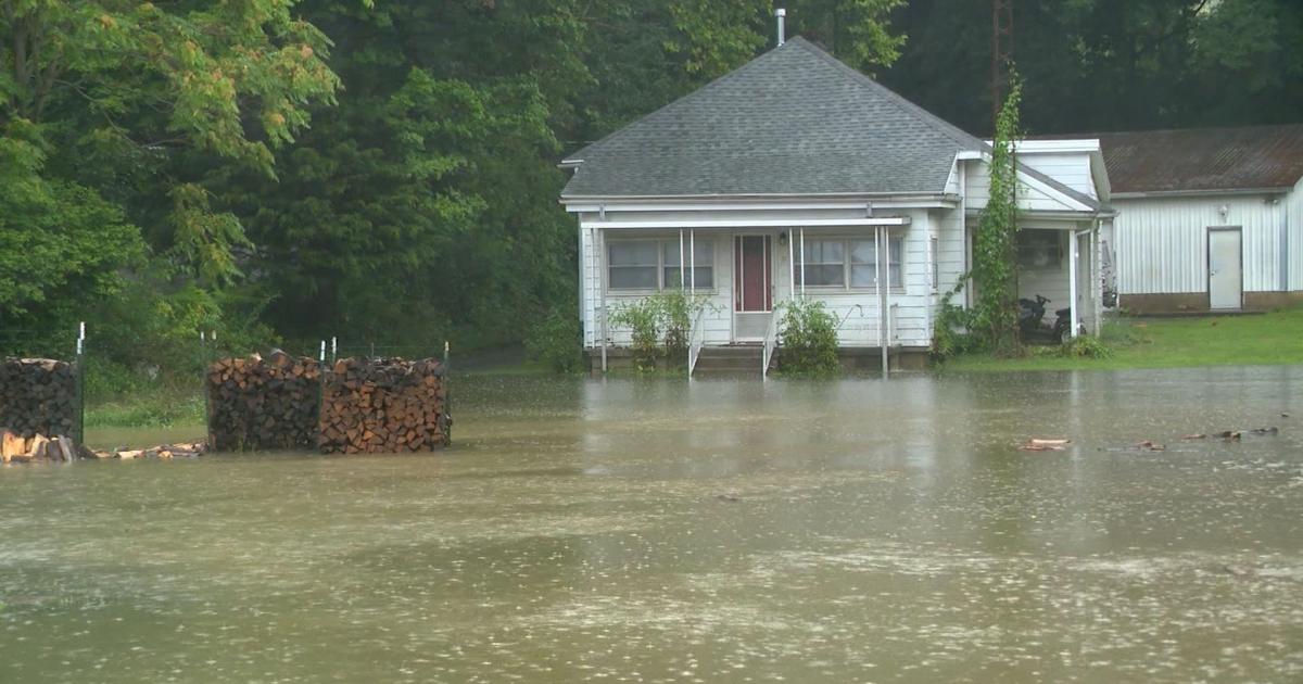
A wave of catastrophic flooding tore through Indiana and Ohio this week, prompting Indiana’s governor to declare a statewide disaster emergency as rivers surged to levels forecasters warned could challenge century-old records, and as tens of millions of people across the Midwest remained under flood alerts heading into the weekend.
Indiana Gov. Mike Braun issued the emergency declaration Thursday after days of relentless rain compounded damage from an earlier derecho — a fast-moving band of destructive thunderstorms — that had already knocked out power to hundreds of thousands of homes and businesses across the region earlier in the week.
“Unprecedented” Flooding Forces Evacuations
Emergency officials in Dearborn County, Indiana, and neighboring Hamilton County, Ohio — home to Cincinnati — ordered residents along the Whitewater River to evacuate Thursday night as floodwaters rose at a pace authorities described as both “unprecedented” and “dangerous.” In Muncie, roughly an hour northeast of Indianapolis, officials worked to clear neighborhoods along the White River after it climbed more than three and a half feet above major flood stage.
“Hoosiers’ safety is my top priority,” Braun said in a statement announcing the declaration. “Our state response is fully mobilized, resources are moving where they’re needed, and we will continue working around the clock to support every impacted community.”
The scale of the flooding has been staggering in some communities. Parts of northern Indiana have received close to 10 inches of rain since Monday, according to the National Weather Service, with some eastern Indiana counties seeing rainfall totals equivalent to several months’ worth of precipitation compressed into a matter of days. In Cambridge City, Indiana, floodwaters rose several feet in the hardest-hit areas, submerging vehicles and pouring into homes through doors and windows. Rescue crews used boats to pull stranded residents from flooded streets.
In Franklin County, near the Ohio border, first responders carried out 45 separate water rescues on Thursday alone, according to a county spokesperson, though no injuries were reported in connection with those operations.
Power Outages and a Deadly Toll
The flooding follows a derecho earlier in the week that brought winds exceeding 100 mph across Illinois, Indiana, Ohio, Kentucky, and parts of West Virginia and Virginia. That storm system alone knocked out power to more than 700,000 customers and contributed to at least three storm-related deaths in Indiana, including a young child killed when a tree fell on a home.
As of Thursday, more than 250,000 homes and businesses in Indiana remained without power, with just under 400,000 customers still affected across the broader Midwest and Ohio Valley region for a second consecutive day. One utility serving northern Indiana said the outages it experienced were the most widespread in its history, with full restoration potentially taking more than a week.
More Rain, More Risk
Forecasters warned the crisis is not yet over. The National Weather Service’s Storm Prediction Center flagged the potential for additional severe storms across Iowa and Illinois, including near Des Moines, Cedar Rapids, Springfield, and Peoria, with damaging winds, large hail, and possible tornadoes all in play.
A Level 3 of 4 risk for flooding rainfall was in effect Thursday for parts of Indiana, southwest Ohio, and north-central Kentucky through early Friday, with forecasters warning that another 1 to 3 inches of rain — and potentially up to 6 inches in localized areas — could fall on ground already saturated from days of downpours. Ohio Gov. Mike DeWine cautioned residents in the western part of his state to remain alert overnight Thursday, warning of “a dangerous situation that very well may develop… while you are asleep.”
Beyond Indiana and Ohio, flood warnings and watches extended into Iowa, Illinois, Kentucky, and Tennessee, with major metro areas including Indianapolis, Des Moines, Louisville, and Nashville all bracing for potential impacts. Roughly 36 million people were under some form of flood alert as of Thursday, according to the National Weather Service.
Looking Ahead
Forecasters expressed cautious optimism that the heaviest rain threat could begin easing by Friday afternoon across the hardest-hit parts of the Ohio Valley, offering communities their first real chance to begin assessing damage and starting recovery efforts. Officials in multiple counties said it remains too early to estimate how many homes have been damaged or destroyed.
In the meantime, residents across the region have been urged to avoid driving through flooded roadways, monitor local emergency alerts, and prepare for the possibility of further evacuations should rivers continue climbing toward record levels in the days ahead.